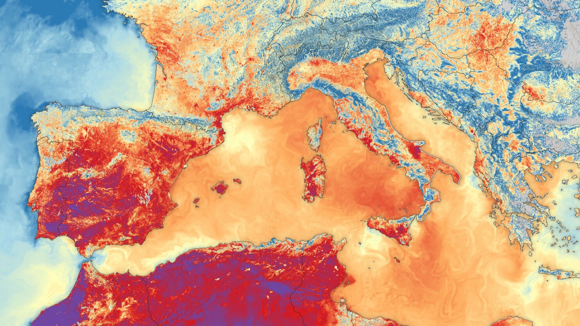
QUICK FACTSWhere is it? Southern Europe and North AfricaWhat's in the photo? Land and sea surface temperatures during one of Europe's record-breaking summer heat wavesWhich satellite took the photo? Sentinel-3BWhen was it taken? June 23, 2026This striking satellite snap shows the scorching land and sea surface temperatures that hit Southern Europe during one of the continent's record-breaking heat waves this summer.The image was created using data from the Sea and Land Surface Temperature Radiometer (SLSTR) on board the European Space Agency's (ESA) Sentinel-3B satellite. It was selected for this week's edition of Earth from space by Simonetta Cheli, director of Earth observation programs at...
'It makes me feel that we can do a lot about it': ESA official shares striking satellite snap of Europe's record-breaking summer heat waves
Original Source
This article was collected from: Live Science
Gabeshana News automatically collects article information
from external RSS/Atom sources. The original article remains
available at the source website. Please visit the original
source for the complete article and the latest information.